
Mingus Mountain
|
On September 25, I drvoe through the town of Cherry to Mingus Mountain, overlooking the Verde Valley. The town of Cottonwood was directly below and the red rocks cliffs of Sedona could be seen an the far side of the valley as thunderheads built up in the distance.
 Ascending Forest Route 132 in the Prescott National Forest.
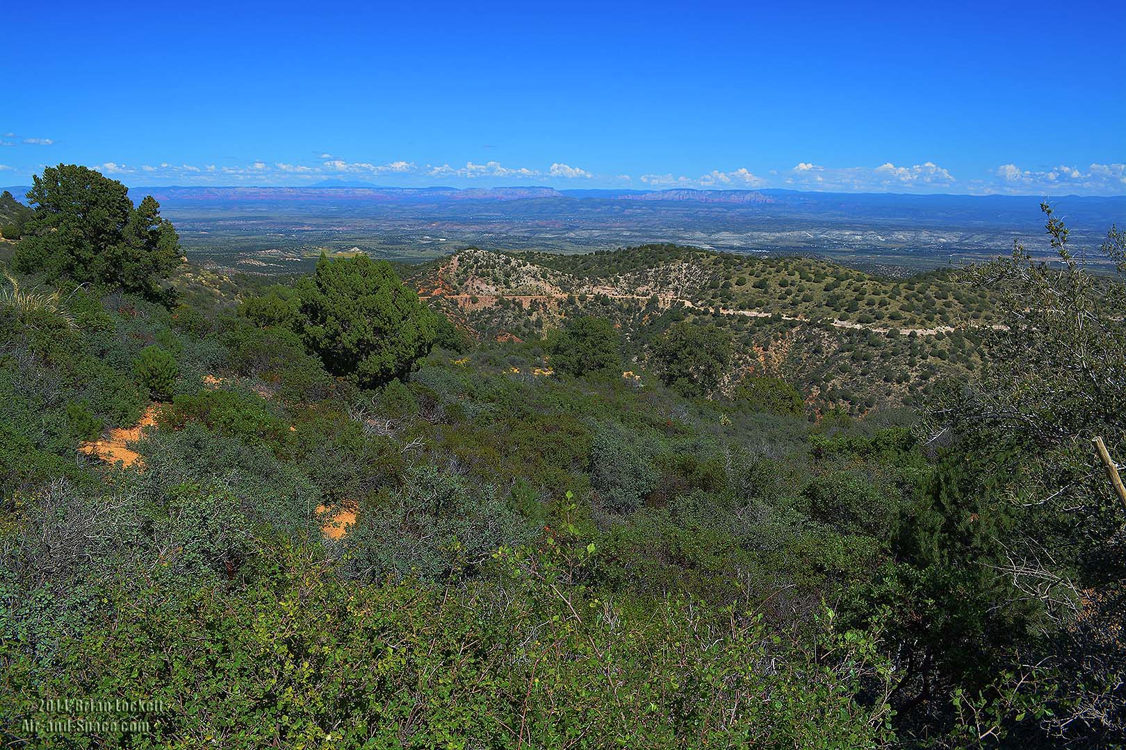
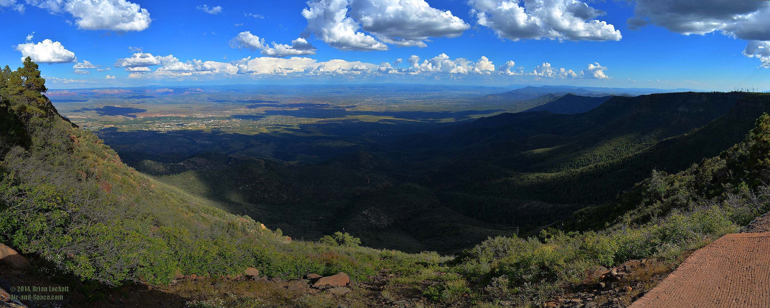
 Panoramic view from the Mingus Mountain Campground day use area.
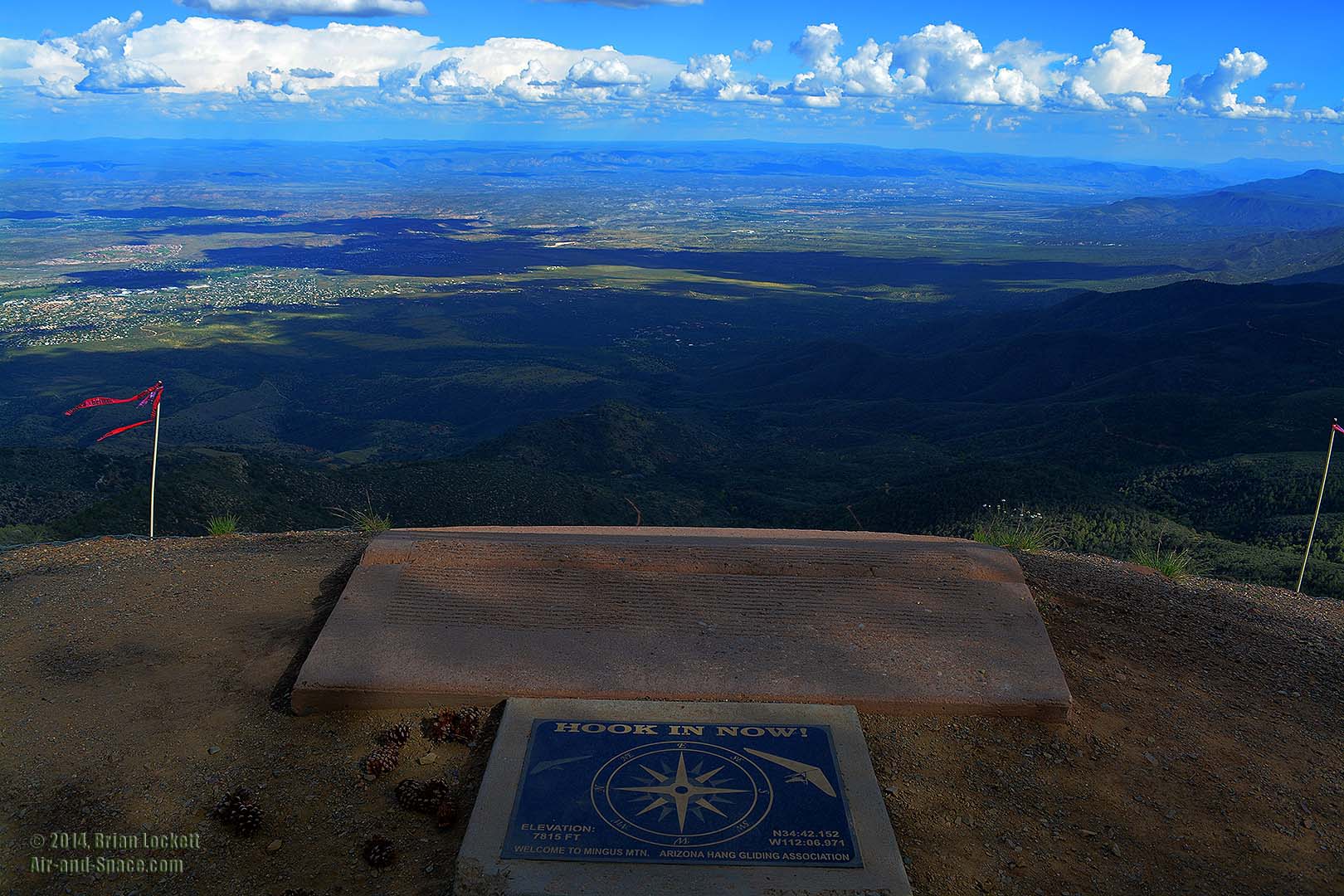 The Arizona Hang Gliding Association maintains a hang
glider launching platform near the campground.
The Arizona Hang Gliding Association maintains a hang
glider launching platform near the campground.
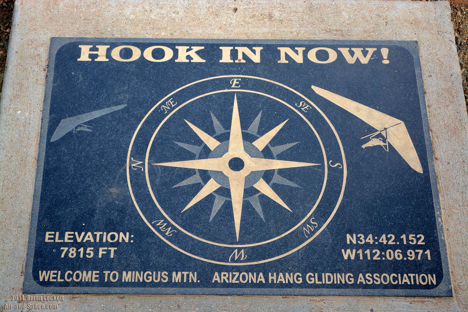 The platform is at the highest point in the mountain range, at an elevation of
7,815 feet. The peak of Mingus Mountain is at an elevation of just 7,730 feet.
The platform is at the highest point in the mountain range, at an elevation of
7,815 feet. The peak of Mingus Mountain is at an elevation of just 7,730 feet.
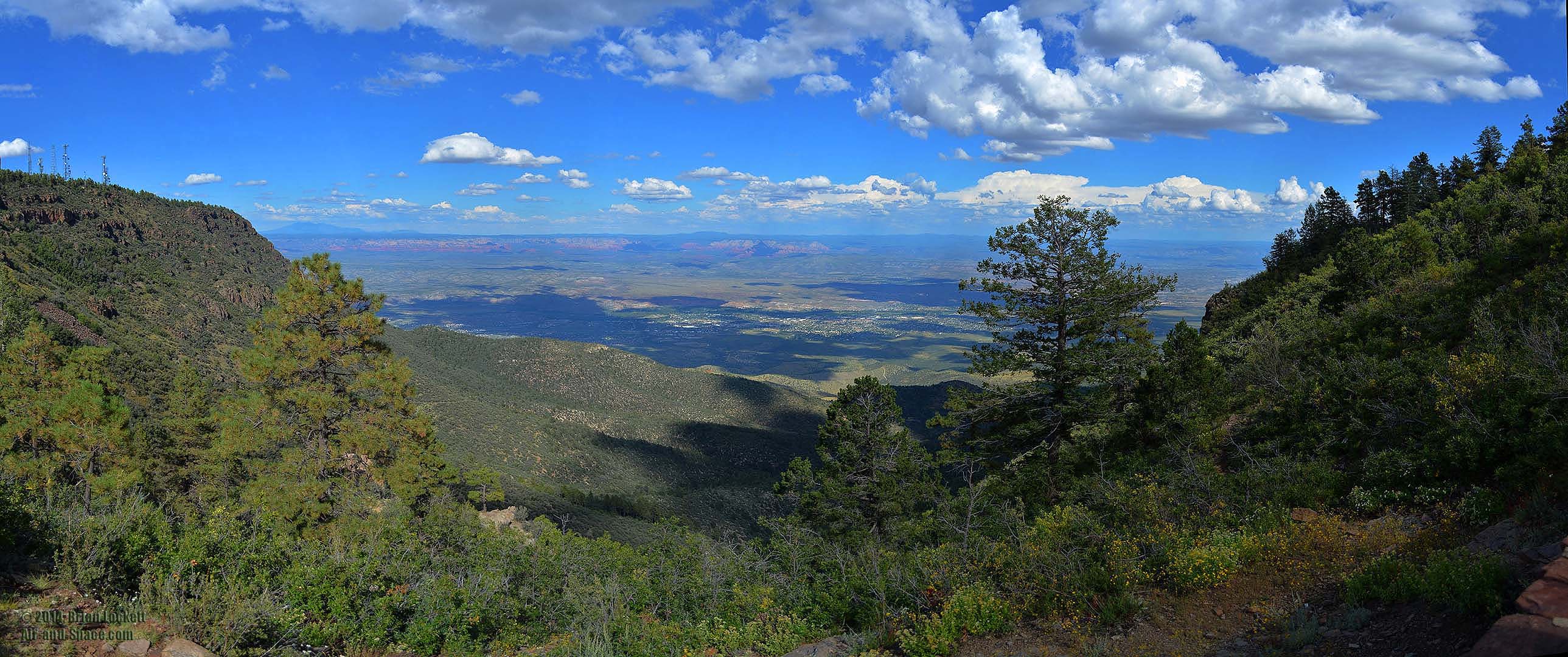
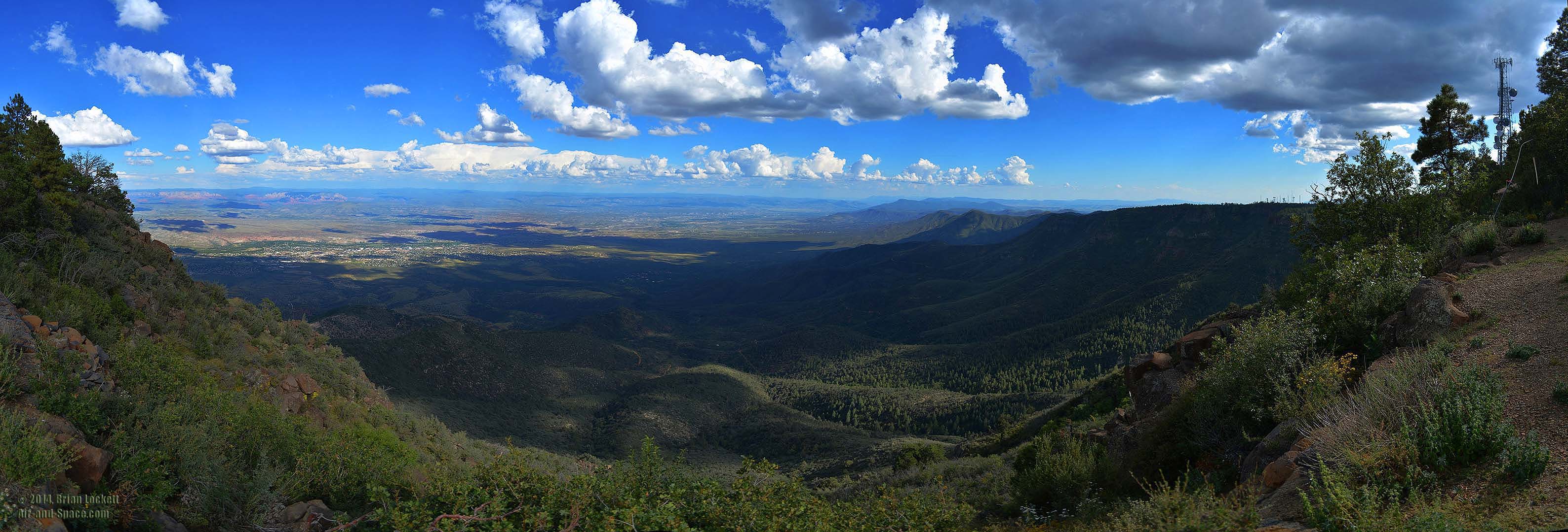
 Panoramic view from the hang glider launching platform.
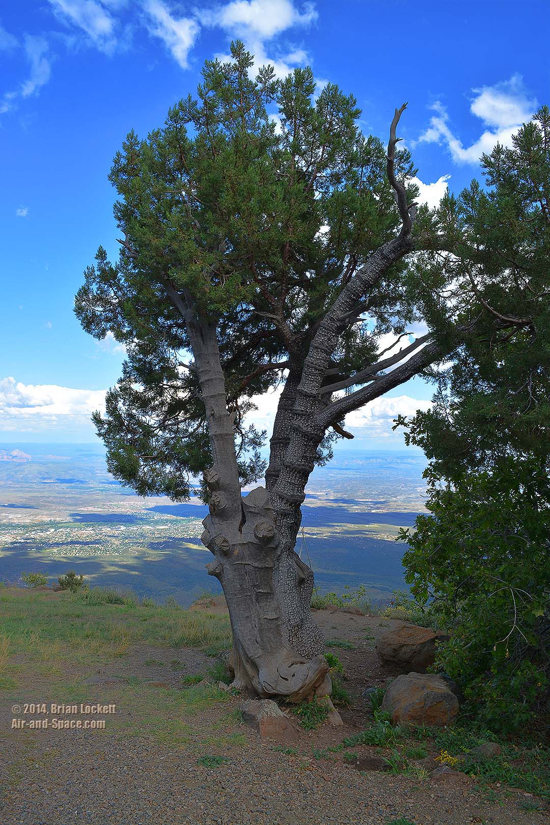 Alligator Juniper
 Panoramic view from the Mingus Mountain Campground.
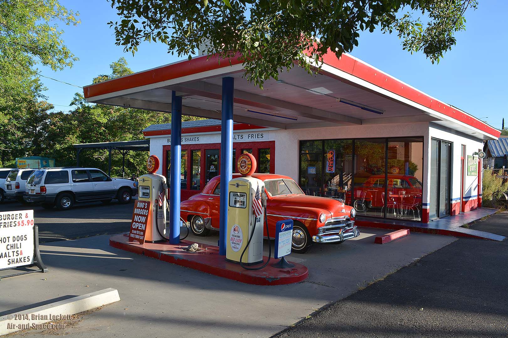 We ended the day with dinner at Bing's Burger Station in Cottonwood. The retro diner serves excellent burgers, hot dogs, and fountain drinks.
Follow @BrianLockett on Twitter for updates on the releases of my new calendars, books, and prints. Watch for coupon codes for special savings on my books and calendars at Lulu.com.
Follow Brian Lockett on Google+.
Follow Brian Lockett on FaceBook.
Visit my channel on YouTube.
Send a message to Brian.